Tropical Cyclone Vardah
From NASA's Earth Observatory: "One week after dropping flooding rains and killing 14 people in southern Thailand, Tropical Cyclone Vardah was poised for landfall along the east coast of India.
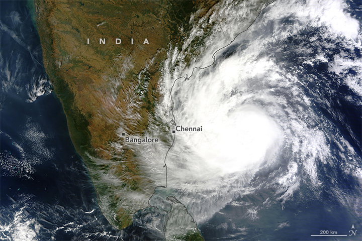
On December 11, 2016, the Moderate Resolution Imaging Spectroradiometer (MODIS) on NASA’s Terra satellite acquired a natural-color image of Vardah (above) as it churned in the Bay of Bengal. Around the same time, the U.S. Joint Typhoon Warning Center reported sustained winds of 75 knots (85 miles or 140 kilometers per hour) and gusts up to 90 knot gusts (105 mph or 165 kmph). Significant wave heights (in the open ocean) approached 24 feet (7.3 meters), and the center of the storm was approximately 640 nautical miles (1030 kilometers) south-southwest of Calcutta.
Two days earlier, the Visible Infrared Imaging Radiometer Suite (VIIRS) aboard the Suomi NPP satellite captured an image of the same storm (below) while it was still below hurricane/cyclone force."
- Log in to post comments